Kristin Folsland Olsen
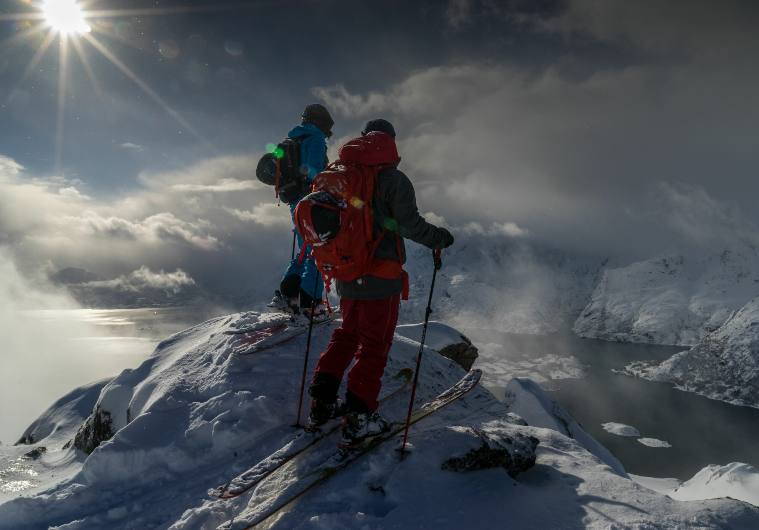
Four great summit tours (winter)
Skiing in the strikingly beautiful scenery, right down to snow-covered beaches is something unique. Going on a top tour in Lofoten is on many people’s wish lists. But where should you go?
It is strongly recommended to use a guide, both in terms of safety, but also for the best skiing experience. The guides know the area and the prevailing conditions and can select the most suitable tours.
If you have sufficient experience and want to go on a private trip, you will find inspiration in this article. Prepare well before the trip!
NB! Feel free to check www.varsom.no for avalanche warnings before you go on a trip.
Usually, the mountains on Austvågøya (largest island in Lofoten) are the most snow-sure. Mountains such as Småtindane, Rundfjellet, and Torskmannen are often visited. Parking can be a challenge during winter in Lofoten. The parking lot in the heart of the Austnesfjorden is therefore a true blessing, located just before you arrive in Laupstad when coming from Svolvær. From here, you can reach classics such as Kvittind, Pilan, and Saufjellet.
In good conditions, there are summit hiking opportunities also further west. On Vestvågøya, Himmeltinden stands out as a favorite, while Stornappstind is a delicious choice on Flakstadøya.
AUSTVÅGØYA
Småtindan (700 masl)
Småtindan, and more specifically Varden, are among Lofoten’s most popular top hiking destinations. It’s not without reason! The east-facing mountain side that stretches up from Kabelvågmarka towards the characteristic top arch offers playful and fun skiing. The view over the Vestfjorden is so beautiful that even local skiing heroes can shed a tear on their hundred and eleventh trip up this classic of a mountain.
Turbeskrivelse
The tour starts at Solbakken, one kilometer west of the center of Kabelvåg. There is a large car park in Mølnosveien, 200 meters from the E10.
From here, you follow the light trail for 1.5 kilometers until you reach the Ski Hut in Kabelvågmarka. Be considerate, and don’t trample the cross-country trails with your fat powder boards! At the ski lodge, the ascent up Ørntindsaksla and further up towards Varden begins.
The last section up into the gap between the two peaks is steeper than 30 degrees, and thus avalanche terrain. Show caution.
Normal descent is the same way you came up, or down Kolbeindalen. At the bottom of Kolbeindalen is landslide terrain. Be conscious of your choice of path.
Note that there is a shooting range at the bottom of Kolbeindalen, so avoid driving down if the flag is raised. That means activity on the shooting range.
Rundfjellet (803 masl.)
Five kilometers as the crow flies north of Svolvær lies Rundfjellet and spreads out like a large, friendly giant. The mountain is easy to climb from several angles, and offers great and varied descents in all directions.
Tour description
The most common way up is from Vaterfjorden, which is a 10-minute drive from Svolvær in the direction of Laupstad. Parking can be found on the left side of the E10 just after Hammerstad Camping. From the car park you walk across the bridge before you can put on your skis and start the approach towards the mountain along the northern shore of Vaterfjordpollen. If the ice is solid, you can take a shortcut across the water. At the foot of the mountain, you have to fight your way up through dense small birch forest before you reach the distinctive ridge that leads you through picturesque terrain towards today’s destination.
When the ridge flattens out, turn in a southerly direction and ascend the marked east ridge. Follow this towards the mountain, then turn around to the north and go up the last airy section towards the large stone cairn that marks the top.
Alternative ascent is from the north side via Kudalsheia. There are limited parking options here.
Rundfjellet offers descent opportunities in all directions. Drive down the same way you came or plan your hiking day according to your form, route and imagination!
VESTVÅGØYA
Himmeltind (962 masl.)
Himmeltind is Vestvågøy’s highest mountain and is a lovely top hiking destination right by the ocean. The large tempting mountainside offers 900 meters of fabulous skiing. If you find good conditions here, you can have the dream day of your life.
Tour description
Drive to Hauklandsstranda and on through the tunnel to Uttakleiv. At the first exit on the right, you will find a car park.
Follow the old road that leads over the tunnel. Continue further up Durmålsdalen and zig-zag your way up. Be aware that you are in avalanche terrain, and that you must be sure of the snow conditions before setting off. Pass the summit at 830 m and continue over the narrow ridge to the cairn on the southern peak (931 m). It is common to stop here. The higher peak to the north (962 m) is inaccessible due to a Nato radar.
The view from Himmeltind is breathtaking. You look down on the beautiful beaches at both Haukland and Uttakleiv. If you have the weather gods on your side, this is the day to take a long lunch break at the top before you tighten your ski boots and point your ski tips down towards the sea.
Take the opportunity to have a refreshing bath at Hauklandsstranda after your ski trip.
FLAKSTADØYA
Stornappstinden – (740 masl.)
Stornappstinden is located in the far northeast of Flakstadøy. Right by the Nappstraumen lies this beautiful mountain that attracts enthusiastic skiers. The road over Nappskaret gives you a small bonus of approx. 60 meters in height. In the spring, it may be just the little extra you need to be able to start skiing from the car park.
Tour description
Towards the top of the mountain, it is a bit more relaxed. Once up at the cairn, you get a nice present: A great view of the sea, mountains and beaches you’ll never forget!
You might think that it doesn’t get more magical than this. But then you realize: The descent remains!
Park at the tiny ski lift in Nappskaret, walk past this and climb up the west side of Litlnappstind. Then continue north until you reach Stornappstinden’s wide western flank. Here you can lay zigzag tracks with large turns. The terrain here is steeper than 30 degrees, which means that you are in avalanche terrain. Consider the snow cover and make safe choices.
Put on the Cruise Control and dance your way down in big, juicy turns the same way you came up.